A National Park where you can hike through fairytale landscapes, taste the best of its cuisine, visit charming towns and enjoy a panoramic road like never before.
The Picos de Europa is one of the most beautiful mountainous areas in Spain. Anchored in the middle of the Cantabrian mountain range, its proximity to the sea means that in this mountainous massif it has several geographical accidents of great interest, making the Picos de Europa the second most visited National Park in Spain, surpassed only by the Teide volcano in the Canary Islands.
Of course, if you like nature, the Picos de Europa is one of those obligatory places to spend a few days on any route through Cantabria. Churches, charming towns, nature and gastronomy are just some of the things that the Picos de Europa offer, and that delight visitors.
The Western massif off Picos de Europa, the Peñas Santas or the Cornión, is the most visited. The classic route through this sector begins in Cangas de Onís, crossed by the untamed Sella. The one that was court of the incipient Asturian kingdom thirteen centuries ago is today a population of 4,500 inhabitants full of hotels and shops that sell gastronomic products and mountain equipment. Just a step away from the hustle and bustle, there are two corners that brim with bucolicism: the pointed bridge, with the Victoria Cross hanging over the waters of the Sella, and the Següencu viewpoint, which offers the first panoramic view over the Picos de Europa.
The Roman Bridge, of medieval invoice, has its origin in the primitive Roman road.
From Cangas de Onís a road leads in a few minutes to Covadonga, one of those places that seem to have been created by nature to amaze. The first thing you see is the Auseva rock emerging from among deciduous forests, with the Holy Cave hanging from the rock and a waterfall gushing out under it. It seems like a dream and, nevertheless, everything is real, although seasoned with the fantastic spirit of the 1877 reconstruction. In this way, architecture is the perfect complement to the cult of Santina and Pelayo, which rests in the place where, the May 28, 722, he won the battle that would forge his epic.
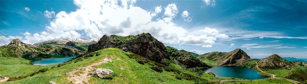
The lakes of Enol and La Ercina are the other sanctuary in the area. The ascent from Covadonga, leaving the beech forests behind, is one of the most followed mountain stages of the Vuelta Ciclista a España: 12.3 kilometers in which a difference in altitude of 910 meters is overcome with slopes of up to 17%. At the top appear the two lakes, first Enol, deeper. Hiking routes for all tastes depart from here, such as those that lead to the Rey and Ordiales viewpoints, the latter further away, or to the Peñas Santas de Enol and Castilla, the second with 2,596 meters of altitude. Throughout these excursions, witnesses of the pastoral culture of the sheepfolds appear, such as the cuerres (wooden closures) for the cattle and the herds of casino cows and lacha sheep that in summer are transferred to the high pastures and with whose milk Gamonéu cheese is made, typical of the councils of Onís and Cangas.
The forest and lake environment of the sanctuary were the origin of the park. The basilica was built in 1901.
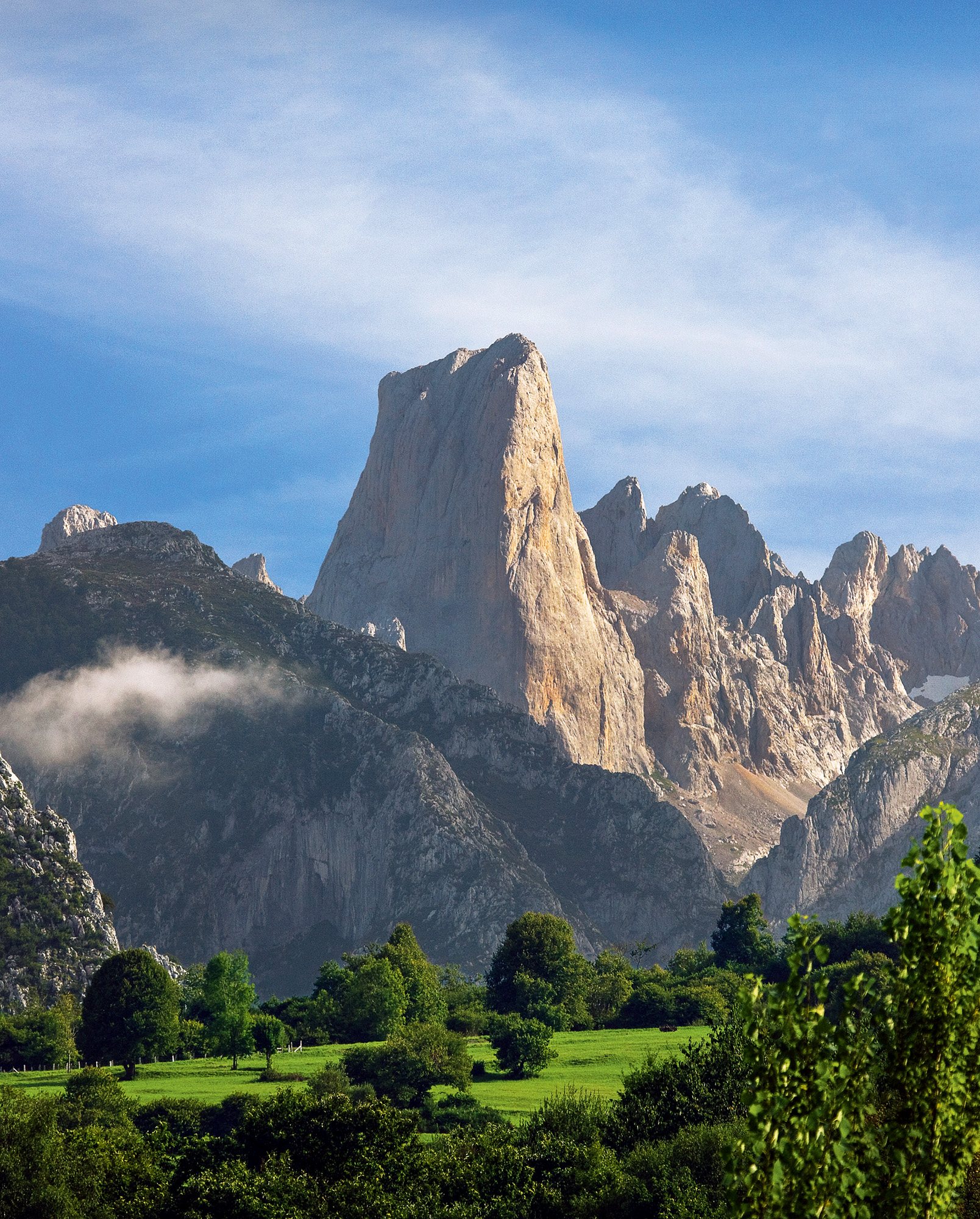
Going up the Güeña river through Onís we reach the Cabrales valley, watered by the Cares river and also famous for its cheese. This is how we enter the Central Massif or Los Urrieles, with the Naranjo de Bulnes or Picu Urriellu totem (2,519 m), which acquires an orange hue at sunset. Its fame comes from being a challenge for climbers, since its west face is a vertical wall of 500 meters that requires spending the night hanging from the wall. Another of the myths of the region is Cabrales cheese, made with raw cow, sheep and goat milk, and matured in natural caves for two to six months until it acquires the fungi that give it the greenish spots, as well as its texture. buttery and its slightly spicy flavor.
If from Arenas de Cabrales the course of the Cares River goes up, after 6 kilometers Poncebos appears. In this village we are offered two ways of accessing the Peña, the name that the cabraliegos give to the massif: through its entrails through the surprising Cares gorge – BY CANAL DEL TEXU, a short but intense 8km walk, or in the Bulnes funicular, which in just seven minutes saves 402 meters of unevenness underground.
Climbing aboard the funicular is like moving to another dimension because, in a jiffy, one is in the middle of the mountain, in a nucleus of only 20 inhabitants that until 2001 had the only access to the Tejo canal path. Today the old trail is a popular excursion (up or down to Poncebos) that lasts about two hours.
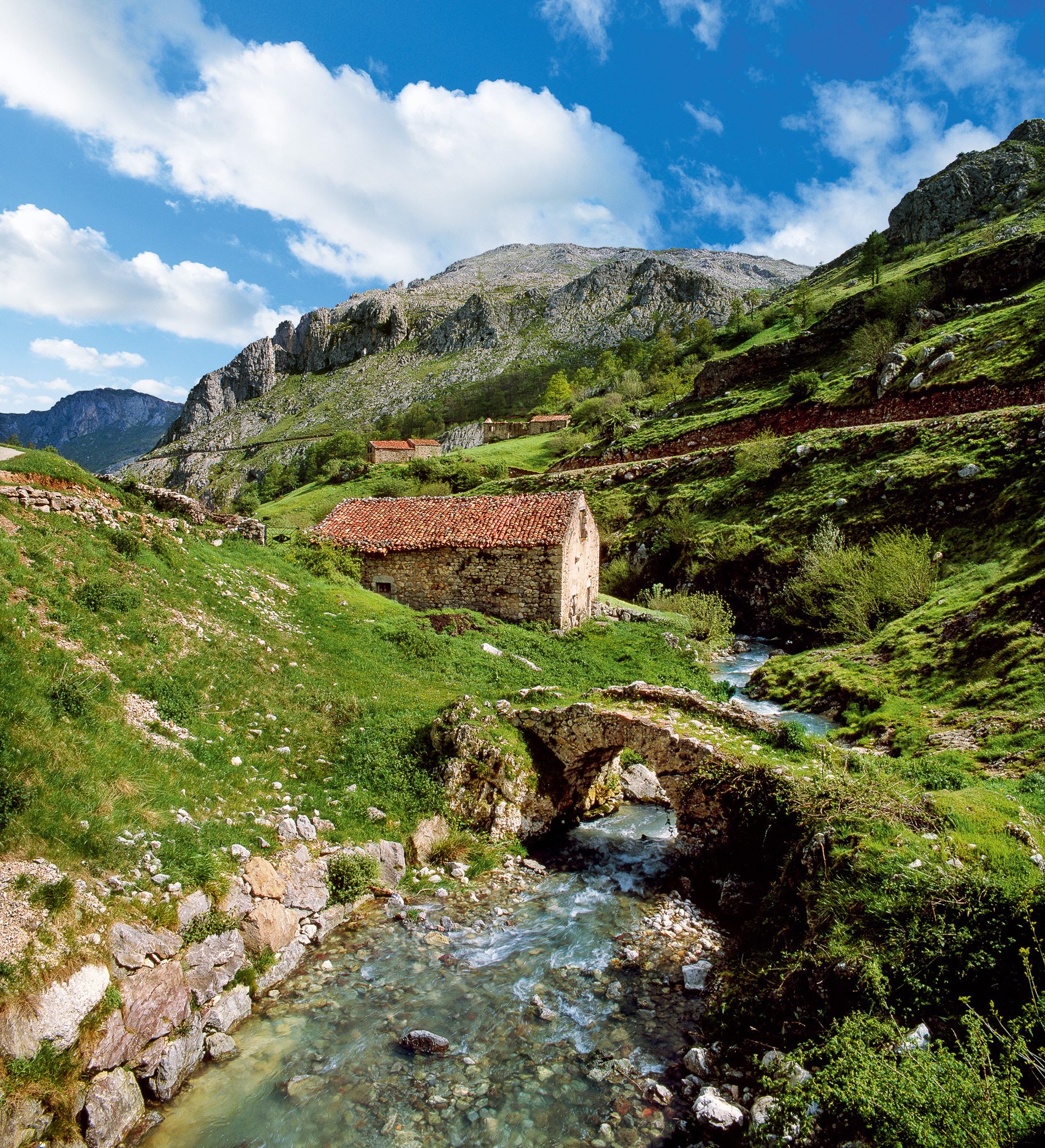
The mountain villages of this area such as Bulnes, Tresviso and Sotres have lived practically isolated until a few decades ago.
The Cares or Divine Throat route is located between the Asturian community and the province of León.
The protagonist of this landscape is none other than the Cares River. Today the trail is mainly a tourist walk of about 11 kilometers (one way) and that for many is one of the most beautiful in all of Spain: it is a path through a gorge, crossing mountains, vertical walls, crossing tunnels and bridges, steep rocky slopes, and always views towards the river from a high vantage point.
The La Hermida gorge, dug by the river Deva and populated by holm oaks, penetrates the Liébana valley (Cantabria), the main access to the eastern massif or Andara. Right at the entrance of the valley, benefited by a microclimate that allows the cultivation of vines, stands the Mozarabic church of Santa María de Lebeña (10th century), with three naves with horseshoe arches and a sacred yew in its atrium.
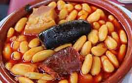
A little further on is Potes, whose emblem is the Torre del Infantado (15th century). This town is the best place to buy the smoked cheeses from Aliva, those from Lebeña and the picón cheese from Tresviso, and also to try the local pomace and the lebaniego stew.
Three kilometers away is the Santo Toribio monastery. In addition to the memory of his abbot Beato de Liébana (VIII-IX century), author of some Commentaries to the Apocalypse that were not missing in any medieval library, he keeps the relic of the Lignum Crucis (fragment of the cross of Christ) and has a Year Saint every time the patron’s feast, April 16, falls on a Sunday.
Fuente Dé, the place where the river Deva is born, once again places us in the middle of the mountain. This is where a cable car starts that in 1966 stopped transporting mineral to take people to the Cable viewpoint, at 1,834 meters. The extraordinary panorama can only be compared to that offered by the Corzo y el Oso viewpoints, on the Leonese side. A spectacle of ridges and valleys full of life and legend.
This town is an excellent base to get to know the La Liébana region.
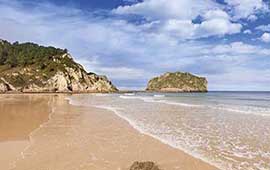
An area bathed by the Cantabrian Sea, green blends with the blue of the sea. From small coves to huge urban sandbanks, the charming beaches that will make you fall in love.
Esta web utiliza cookies para que podamos ofrecerte la mejor experiencia de usuario posible. La información de las cookies se almacena en tu navegador y realiza funciones tales como reconocerte cuando vuelves a nuestra web o ayudar a nuestro equipo a comprender qué secciones de la web encuentras más interesantes y útiles.
Cookies estrictamente necesarias
Las cookies estrictamente necesarias tiene que activarse siempre para que podamos guardar tus preferencias de ajustes de cookies.
Si desactivas esta cookie no podremos guardar tus preferencias. Esto significa que cada vez que visites esta web tendrás que activar o desactivar las cookies de nuevo.